
8-800-700-45-64
Заказать звонок
Free hotline
Free hotline

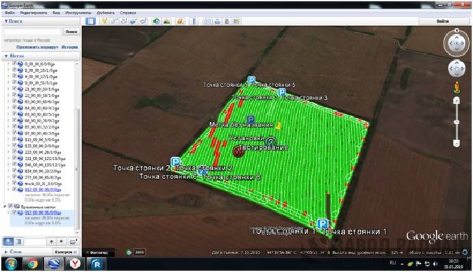
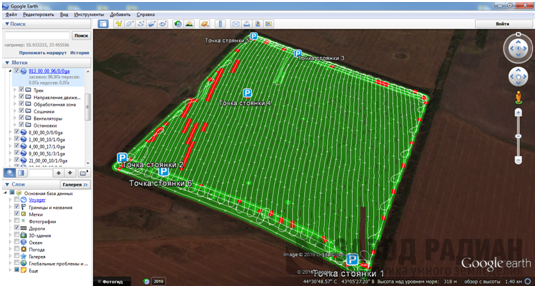
“Field mapping” function allows to show the sowing on navigator’s monitor and then on PC display with electronic media (Google Earth program).
Farm operator has a possibility to analyze the sowing campaign based on the information available:
tractor’s direction
acreage planted
seeder’s stops
numbers of clogged coulters
ustable sowing distance
vent’s low rotary speed
availability of seeds in the feeders
tractor’s speed